No debate from the OP makes this an easy rebuttal. Yey!
I put this together for my grandsons, as they had been exposed to the nonsense of flat Earth conspiracy and were wondering about it. A wise man once said: "Those who continue to deny the reality of proof, despite compelling evidence presented to them many times over, are fools and as such can be dismissed without further consideration".
The witness of men, indeed. You set up a false premise with that and then ran with it. I recommend the study of logic to you. It should help with understanding what a logical fallacy is and prevent the use of circular argument in future, perhaps. Other considerations such as the 'either or dichotomy' or 'excluded middle' and also 'fallacy by omission' may also be helpful to you.
However, here we do prefer to show our evidences and rebuttals, so here you go. There are simple experiments that can be done by any layperson in this article which can show you for yourself the concepts that are explained here, such as the sticks and the observation of horizons:
Varying Star Constellations
This observation was originally made by Aristotle (384-322 BCE), who declared the Earth was round judging from the different constellations one sees while moving away from the equator. After returning from a trip to Egypt, Aristotle noted that “there are stars seen in Egypt and Cyprus which are not seen in the northerly regions.”
This phenomenon can only be explained with a round surface, and Aristotle continued and claimed that the sphere of the Earth is “of no great size, for otherwise the effect of so slight a change of place would not be quickly apparent.” (De caelo, 298a2-10)
The farther you go from the equator, the farther the ‘known’ constellations go towards the horizon, and are replaced by different stars. This would not have happened if the world was flat.
flat stRS.jpg
not flat strs.jpg
Shadows ( and sticks... )
If you place a stick in the ground, it will produce a shadow. The shadow moves as time passes (which is the principle for ancient Shadow Clocks). If the world had been flat, then two sticks in different locations would produce the same shadow. But they don’t. This is because the earth is round, and not flat:
shodstickj.jpg
shadows sticks.jpg
Seeing Farther from Higher
Standing in a flat plateau, you look ahead of you towards the horizon. You strain your eyes, then take out your favorite binoculars and stare through them, as far as your eyes (with the help of the binocular lenses) can see.
Then, you climb up the closest tree – the higher the better, just be careful not to drop those binoculars and break their lenses. You then look again, strain your eyes, stare through the binoculars out to the horizon.
The higher up you are the farther you will see. Usually, we tend to relate this to Earthly obstacles, like the fact we have houses or other trees obstructing our vision on the ground, and climbing upwards we have a clear view, but that’s not the true reason. Even if you would have a completely clear plateau with no obstacles between you and the horizon, you would see much farther from greater height than you would on the ground.
This phenomena is caused by the curvature of the Earth as well, and would not happen if the Earth was flat:
horizony.jpg
hozon.jpg
The Existence of Timezones
The time in New York, at the moment these words are written, is 12:00pm. The sun is in the middle of the sky (though it’s hard to see with the current cloud coverage). In Beijing, where Michael Phelps is likely getting ready for yet another gold medal, it’s 12:00am, midnight, and the sun is nowhere to be found.
In Adelaide, Australia, it is 1:30am. More than 13 hours ahead. There, the sunset is long gone – so much so, that it’s soon going to rise up again in the beginning of a new day. This can only be explained if the world is round, and rotating around its own axis. At a certain point when the sun is shining on one part of the Earth, the opposite side is dark, and vise versa. That allows for time differences and timezones, specifically ones that are larger than 12 hours.
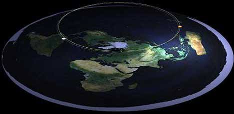
Another point concerning timezones, the sun and flat/spherical Earth: If the sun was a “spotlight” (very directionally located so that light only shines on a specific location) and the world was flat, we would have seen the sun even if it didn’t shine on top of us (as you can see in the drawing below). The same way you can see the light coming out of a spotlight on a stage in the theater, even though you – the crowd – are in the dark. The only way to create two distinctly separate timezones, where there is complete darkness in one while there’s light in the other, is if the world is 'spherical'
timezone1.jpg
timezone1.jpg
timezone2.jpg
The Moon
Now that humanity knows quite positively that the Moon is not a piece of cheese or a playful god, the phenomena that accompany it (from its monthly cycles to lunar eclipses) are well-explained. It was quite a mystery to the ancient Greeks, though, and in their quest for knowledge, they came up with a few insightful observations that helped humanity figure out the shape of our planet. Aristotle (who made quite a lot of observations about the spherical nature of the Earth) noticed that during lunar eclipses (when the Earth’s orbit places it directly between the Sun and the Moon, creating a shadow in the process), the shadow on the Moon’s surface is round.
This shadow is the Earth’s, and it’s a great clue on the spherical shape of the Earth. Since the earth is rotating (see the “Foucault Pendulum” experiment for a definite proof, if you are doubtful), the consistent oval-shadow it produces in each and every lunar eclipse proves that the earth is not only round but spherical – absolutely, utterly, beyond a shadow of a doubt not flat. The tides on Earth are mostly generated by the gradient in intensity of the Moon's gravitational pull from one side of Earth to the other, the tidal forces. This forms two tidal bulges on Earth, which are most clearly seen in elevated sea level as ocean tides.
Because Earth spins about 27 times faster than the Moon moves around it, the bulges are dragged along with Earth's surface faster than the Moon moves, rotating around Earth once a day as it spins on its axis. The ocean tides are magnified by other effects: frictional coupling of water to Earth's rotation through the ocean floors, the inertia of water's movement, ocean basins that get shallower near land, and oscillations between different ocean basins. The tidal effect of the Sun on Earth's oceans is almost half that of the Moon, and their gravitational interplay is responsible for spring and neap tides
Refer to the following image for more details on what happens during a lunar eclipse:
eclipses.jpg
2 moons.jpg
Ships and the Horizon
If you’ve been next to a port lately, or just strolled down a beach and stared off vacantly into the horizon, you might have, perhaps, noticed a very interesting phenomenon: approaching ships do not just “appear” out of the horizon (like they should have if the world was flat), but rather emerge from beneath the sea.
But – you say – ships do not submerge and rise up again as they approach our view (except in “Pirates of the Caribbean”, but we are hereby assuming that was a fictitious movie). The reason ships appear as if they “emerge from the waves” is because the world is not flat: it’s round.
Imagine an ant walking along the surface of an orange, into your field of view. If you look at the orange “head on”, you will see the ant’s body slowly rising up from the “horizon”, because of the curvature of the Orange. If you would do that experiment with a long road, the effect would have changed: The ant would have slowly ‘materialized’ into view, depending on how sharp your vision is.
antorange.jpg
Geodesy:
Geodesy, also called geodetics, is the scientific discipline that deals with the measurement and representation of the Earth, its gravitational field and geodynamic phenomena (polar motion, Earth tides, and crustal motion) in three-dimensional time-varying space.
Geodesy is primarily concerned with positioning and the gravity field and geometrical aspects of their temporal variations, although it can also include the study of Earth's magnetic field. Especially in the German speaking world, geodesy is divided into geomensuration ("Erdmessung" or "höhere Geodäsie"), which is concerned with measuring the Earth on a global scale, and surveying ("Ingenieurgeodäsie"), which is concerned with measuring parts of the surface.
geodesy.jpg
The Earth's shape can be thought of in at least two ways;
As the shape of the geoid, the mean sea level of the world ocean; or
As the shape of Earth's land surface as it rises above and falls below the sea.
As the science of geodesy measured Earth more accurately, the shape of the geoid was first found not to be a perfect sphere but to approximate an oblate spheroid, a specific type of ellipsoid. More recent measurements have measured the geoid to unprecedented accuracy, revealing mass concentrations beneath Earth's surface.
Causes for geoid anomalies
Gravity and Geoid anomalies caused by various crustal and lithospheric thickness changes relative to a reference configuration. All settings are under local isostatic compensation.
Variations in the height of the geoidal surface are related to density anomalous distributions within the Earth. Geoid measures help thus to understand the internal structure of the planet. Synthetic calculations show that the geoidal signature of a thickened crust (for example, in orogenic belts produced by continental collision) is positive, opposite to what should be expected if the thickening affects the entire lithosphere.
Specifically, the geoid is the equipotential surface that would coincide with the mean ocean surface of the Earth if the oceans and atmosphere were in equilibrium, at rest relative to the rotating Earth and extended through the continents (such as with very narrow canals). According to Gauss, who first described it, it is the "mathematical figure of the Earth", a smooth but highly irregular surface whose shape results from the uneven distribution of mass within and on the surface of the Earth.
It does not correspond to the actual surface of the Earth's crust, but to a surface which can only be known through extensive gravitational measurements and calculations. Despite being an important concept for almost two hundred years in the history of geodesy and geophysics, it has only been defined to high precision since advances in satellite geodesy in the late 20th century. It is often described as the true physical figure of the Earth, in contrast to the idealized geometrical figure of a reference ellipsoid.
In geodesy, a reference ellipsoid is a mathematically defined surface that approximates the geoid, the truer figure of the Earth, or other planetary body. Because of their relative simplicity, reference ellipsoids are used as a preferred surface on which geodetic network computations are performed and point coordinates such as latitude, longitude, and elevation are defined.
geodesy2.jpg
The gravitational field of the earth is neither perfect nor uniform. A flattened ellipsoid is typically used as the idealized earth, but even if the earth were perfectly spherical, the strength of gravity would not be the same everywhere, because density (and therefore mass) varies throughout the planet. This is due to magma distributions, mountain ranges, deep sea trenches, and so on.
If that perfect sphere were then covered in water, the water would not be the same height everywhere. Instead, the water level would be higher or lower depending on the particular strength of gravity in that location.